 User's Guide
User's Guide Malaysia Sea Level Rise (MySLR)
Introduction
MySLR is a web-based system owned by NAHRIM. This system contains Spatial data based on Geographic Information System (GIS) and provides spatial informations for multi-party referrals whether public, private and academic sectors. It is also developed to help this multiparty referrals making decision for future development.
Web Map
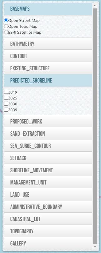
MySLR have 8 different web maps.
- Basemap
- Management Unit (MU) Map
- Coastal Map
- Environmental Map
- Land Use Map
- Zoning Map
- Recreational & Tourism Map
- Archaeological & Historical Map
Functions
Sidebar
This sidebar contains the disclaimer of the system. User needs to read it before using the system.

Home
This home button will navigate user back to landing page.

Zoom
This function allows user to zoom in and out on the map. The '+' button is use to zoom in and the '-' button is use to zoom out. In addition, using a scrollable mouse will benefit user more as it ease the user to zoom in and out only by scrolling the mouse.

Layer & Feature
Each map has different layers depending on its category. The layers may contain points, lines or polygons which is called as a features. All the feature are clickable.
Layer Control
The layer control allow users to display or hide layers on map. User needs to hover on the layer control button and click the small box beside the layer's name. If the box is checked, the layer will be shown on map. Otherwise, it is hidden.

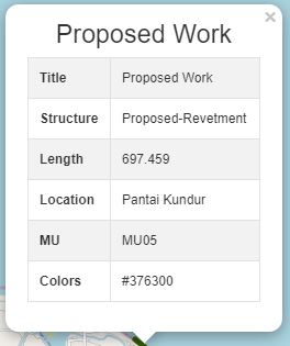
Attribute Table
The attribute table display attributes of each feature on maps. User needs to click on the feature and the table will pop up displaying all the attribute of the selected feature.
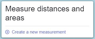
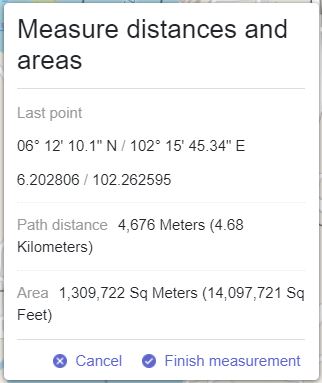
Measure Distance & Area
This function allows user to measure distance or area on the map. To use this function, user needs to hover to the measure button and click 'Create a new measurement'. Then, when the cursor turns red, user needs to click on points where it is needed to be measure. Finally, the system will produce the result.

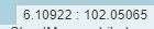
Coordinate & Scale
The coordinate function displays geographic coordinates of the mouse pointer, as it is moved about the map. Furthemore, the scale function represents the ratio of a distance on the map to the actual distance on the ground.
Browser Support
MySLR supports the following browsers:
- IE9+
- Firefox (latest)
- Safari (latest)
- Chrome (latest)
- Opera (latest)
FAQ
Why different attribute table pop up when multiple layer is overlap?
The most recent layer being enable on the layer control will be on top of the overlap layer. This issue usually occur on polygon features when multiple layer is enable concurrently. If the selected feature pop up is showing different layer content, disable the desired layer and enable it back. This will make the selected layer on top of the other layer.